MAKE A MEME
View Large Image
| View Original: | Saltdeposition.jpg (654x597) | |||
| Download: | Original | Medium | Small | Thumb |
| Courtesy of: | commons.wikimedia.org | More Like This | ||
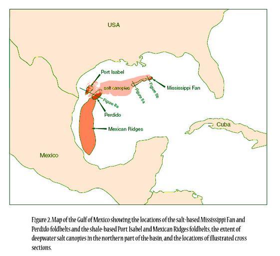
| Keywords: Saltdeposition.jpg en Figure 2 Map of the Gulf of Mexico showing the locations of the salt-based Mississippi Fan and Perdido foldbelts and the shale-based Port Isabel and Mexican Ridges foldbelts the extent of deepwater salt canopies in the northern part of the basin and the locations of illustrated cross sections http //www beg utexas edu/indassoc/agl/members/ss19/Chpt11/FOLDBELT3 PDF Mark G Rowan Frank J Peel Bruno C Vendeville 2000-08 Maps of the Gulf of Mexico | ||||