MAKE A MEME
View Large Image
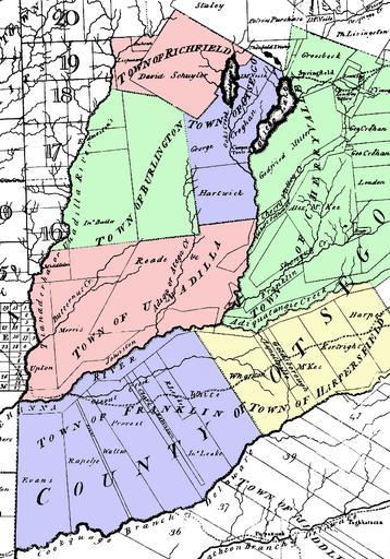
| View Original: | Simeon_DeWitt_Otsego_County_NY_c.1792.png (729x1044) | |||
| Download: | Original | Medium | Small | Thumb |
| Courtesy of: | commons.wikimedia.org | More Like This | ||
| Keywords: Simeon DeWitt Otsego County NY c.1792.png Map of Otsego County New York c 1792 Note that the county was larger than it is now but with fewer towns This was taken from a larger map by surveyor general Simeon De Witt and colored by me The county's towns at the time included Burlington Cherry Valley Franklin now a part of Delaware County New York Harpersfield now a part of Delaware County New York Otsego Richfield Unadilla PD-old Old maps of New York Maps by Simeon De Witt Maps of Otsego County New York Images by R A Nonenmacher Maps | ||||