MAKE A MEME
View Large Image
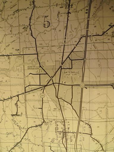
| View Original: | Tallahatchie_River_Head_of_Navigation,_Batesville.JPG (2736x3648) | |||
| Download: | Original | Medium | Small | Thumb |
| Courtesy of: | commons.wikimedia.org | More Like This | ||
| Keywords: Tallahatchie River Head of Navigation, Batesville.JPG en General Highway Map Panola County Mississippi Tallahatchie River's head of navigation City of Batesville Miss April 1979 Bobo Bayou US Interstate Highway 55 1981-01-01 00 50 53 Mississippi State Highway Department Transportation Planning Division in cooperation with the U S Department of Transportation Federal Highway Administration other versions PD-USGov Maps of rivers in Mississippi Maps of oxbow lakes Maps of the Tallahatchie River Navigation Uploaded with UploadWizard Interstate 55 Batesville Little Tallahatchie River Bridge U S Highway 51 Water transport in Mississippi Bear hunting Riparian forests | ||||