MAKE A MEME
View Large Image

| View Original: | Termopili ancient topo 480BC-it.svg (701x595) | |||
| Download: | Original | Medium | Small | Thumb |
| Courtesy of: | commons.wikimedia.org | More Like This | ||
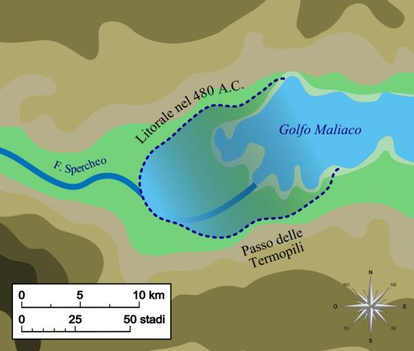
| Keywords: Termopili ancient topo 480BC-it.svg it Mappa del golfo di Malia con la ricostruzione del litorale nel 480 a C all'epoca della battaglia delle Termopili Basato sulla figura 3 19 di 'Geoarchaeology The Earth-science Approach to Archaeological Interpretation p 96 George Robert Rapp Christopher L Hill Yale University Press 2006 ISBN 0300109660 Thermopylae_map_480bc png 50 2013-11-10 17 12 UTC Thermopylae_map_480bc png ChrisO derivative work Fulvio314 Laboratorio grafico mappa Italian translation topography vectorization Fulvio314 Thermopylae_map_480bc png Original upload log This image is a derivative work of the following images File Thermopylae_map_480bc png licensed with PD-self 2008-09-30T23 59 26Z ChrisO 542x417 24320 Bytes <nowiki> en Map of Thermopylae area with modern shoreline and reconstructed shoreline of 480 BC Loosely based on figure 3 19 in Geoarchaeology The Earth-science Approach to Archaeological Interpretat</nowiki> Maps of Thermopylae | ||||