MAKE A MEME
View Large Image
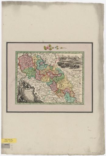
| View Original: | Territorialkarte_von_Schlesien_-_Le_Rouge_1745.png (8067x11864) | |||
| Download: | Original | Medium | Small | Thumb |
| Courtesy of: | commons.wikimedia.org | More Like This | ||
| Keywords: Territorialkarte von Schlesien - Le Rouge 1745.png Territorialkarte von Schlesien Kupferstich 26 x 20 cm Verlegt be Le Rouge in Paris um 1745 ---- Le Duché / de Silesie divisé en / XVII Principautées / à Paris / Par et chez le S<sup>r</sup> le / Rouge Ing<sup>r</sup> Geog / rue des Augustins / Avec Priv du Roi Sächsische Landesbibliothek SLUB Kartensammlung Inv-Nr SLUB/KS A15110<br /><small>Scan http //www deutschefotothek de/documents/obj/90009023 SLUB / Deutsche Fotothek</small> ~ 1745 Creator Georges Louis Le Rouge PD-old Old maps of Silesia Maps by Georges Louis Le Rouge Coats of arms on maps | ||||