MAKE A MEME
View Large Image

| View Original: | The_Quarterly_journal_of_the_Geological_Society_of_London_(13205826403).jpg (1199x2069) | |||
| Download: | Original | Medium | Small | Thumb |
| Courtesy of: | commons.wikimedia.org | More Like This | ||
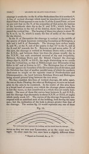
| Keywords: The Quarterly journal of the Geological Society of London (13205826403).jpg 1846 <br> SHARPE ON SLATY CLEAVAGE <br> 95 <br> cleavage is southerly ; to the S of the Stokenham line it is northerly <br> A line of vertical cleavage which must be considered identical with <br> thatof Start Point appears to run to the N of the Lizard Point ; at least <br> we are told that on the N of the serpentine of that point the laminae <br> of the hornblende slate dip to the N and N W which being the <br> reverse direction to the rest of the district shows that we have here <br> passed the vertical line The bearing of these two places is about W <br> by S to E by N which is nearly the line of strike of the cleavage <br> for the district <br> In the N of Devonshire the cleavage is vertical in the middle of <br> the quarry of black limestone containing Goniatites at Bickington a <br> mile and a half S of Barnstaple The cleavage here strikes nearly <br> E and W ; at the N end of the quarry it dips 70° to the S and at <br> the S end 80° towards the N Between six and seven miles N of <br> this spot the cleavage is vertical at Swinham Down with a strike to <br> the E N E and between these two lines the planes usually dip to <br> the N N W but with occasional reversal of dip and irregularity <br> Between Swinham Down and the Bristol Channel the cleavage <br> always dips S S S W or S SE the angle diminishing as we recede <br> from the vertical line so that at Hillsborough near Ilfracombe it has <br> fallen to 60° and at Linton to 35° The Bickington line of vertical <br> cleavage appears the boundary of the Devonshire area of elevation and <br> the Swinham line that of another parallel area of which the northern <br> limit must be sought on the opposite coast of Pembrokeshire and <br> Glamorganshire ; the band between Swinham Down and Bickington <br> being neutral ground lying between the two areas <br> We thus establish two lines of vertical cleavage 60 miles apart <br> the one at Stoke Fleming the other at Bickington to serve as bound- <br> aries to the area to be examined In the centre of this area there <br> is a broad band of country over which the cleavage planes undulate <br> in low flat waves so that considered as a whole they are nearly hori- <br> zontal The axes of these flat curves bear between E and E N E <br> and the cleavage dips alternately to about N N W or S S E at angles <br> which rarely reach 10° The curves of the cleavage frequently cor- <br> respond with an anticlinal arch of the bedding both having the same <br> axis ; but the inclination of the beds is always greater than that of <br> the cleavage The section fig 19 would represent any one of these <br> Fig 19 <br> The continuous lines represent the bedding and the dotted lines the cleavage <br> waves as they are seen near Launceston or on the coast near Tin- <br> tagel In other cases the two axes have a slightly difl'erent direc- <br> Report on Cornwall c p 77 36932824 113687 51125 Page 95 Text v 3 http //www biodiversitylibrary org/page/36932824 1847 Geological Society of London NameFound Goniatites NameConfirmed Goniatites De Haan 1825 EOLID 4781514 Biodiversity Heritage Library The Quarterly journal of the Geological Society of London v 3 1847 Geology Periodicals Smithsonian Libraries bhl page 36932824 dc identifier http //biodiversitylibrary org/page/36932824 smithsonian libraries Information field Flickr posted date ISOdate 2014-03-17 Check categories 2015 August 26 CC-BY-2 0 BioDivLibrary https //flickr com/photos/61021753 N02/13205826403 2015-08-26 12 53 46 cc-by-2 0 PD-old-70-1923 The Quarterly journal of the Geological Society of London 1847 Photos uploaded from Flickr by Fæ using a script | ||||