MAKE A MEME
View Large Image

| View Original: | Thomas_Ridout_map_of_Grand_River_Indian_Lands,_1821.jpg (4000x5498) | |||
| Download: | Original | Medium | Small | Thumb |
| Courtesy of: | commons.wikimedia.org | More Like This | ||
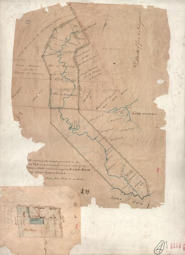
| Keywords: Thomas Ridout map of Grand River Indian Lands, 1821.jpg This is a survey of the Six Nation Indian lands completed in 1821 It is sometimes called the Ridout Survey because Thomas Ridout was the Surveyor General of Upper Canada at the time The image depicts the lands granted to the Six Nation Indians along the Grand River in Upper Canada The Haldimand Proclamation of 1784 granted the land The original survey was undertaken in 1791 to define the area but records of it were lost See en Haldimand Proclamation for historical information Also Charles M Johnson The Valley Of The Six Nations A Collection of Documents on the Indian Lands of the Grand River 1964 University of Toronto Press has a great deal of information on the subject A version is available online at the University of Toronto Library http //link library utoronto ca/champlain/item_record cfm Idno 9_96899 lang eng query The 20AND 20Valley 20AND 20Of 20AND 20The 20AND 20Six 20AND 20Nations searchtype Title startrow 1 Limit All Johnston here en This is a scan of a 1821 survey from Public Archives of Canada Public Archives of Canada Thomas Ridout 2009-08-20 PD-old Grand River Ontario Old maps of Canada Maps of Ontario | ||||