MAKE A MEME
View Large Image
| View Original: | Transisalania_Provincia_;_Vulgo_Over-yssel_(Nicolaas_ten_Have).jpg (5500x4341) | |||
| Download: | Original | Medium | Small | Thumb |
| Courtesy of: | commons.wikimedia.org | More Like This | ||
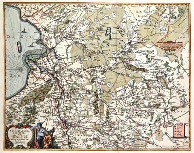
| Keywords: Transisalania Provincia ; Vulgo Over-yssel (Nicolaas ten Have).jpg en Originally made in 1652 by Nicolaas ten Have Part of a series of four maps depicting the Netherlands Contrary to other North-Netherland provinces it was not until the middle of the 17th century that an accurate map of Overijssel became available The province was surveyed between 1640 and 1650 by Nicolaas ten Have conrector of the Latin School in Zwolle Ten Have published his attractive general map in four sheets in 1652 In Dutch atlases from the 17th and 18th centuries reductions of this map were Atlas van der Hagen - http //resolver kb nl/resolve urn urn gvn KONB01 1049B11_098 size large - Source page at the http //resolver kb nl/resolve urn urn gvn KONB01 236 Geheugen van Nederland / Memory of the Netherlands website Koninklijke Bibliotheek Nicolaas ten Have; Publisher Nicolaum Visscher > 1681 PD-old-100 PD-old Old maps of Overijssel Atlas van der Hagen Lordship of Overijssel Coats of arms on maps Ships on maps Nicolaas ten Have | ||||
.jpg)