MAKE A MEME
View Large Image

| View Original: | Tur1952.svg (738x740) | |||
| Download: | Original | Medium | Small | Thumb |
| Courtesy of: | commons.wikimedia.org | More Like This | ||
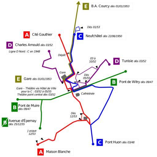
| Keywords: Tur1952.svg Réseau du Service Urbain d'Autobus de la Ville de Reims en 1952 et évolutions depuis 1944 et jusqu'en 1956 Autobus network in Reims in year 1939 and improvements from 1944 till 1956 Plus d'un siècle de transports en commun à Reims M Chenu et M Jailliard adapté par moi-même / adapted by myself 2007-11-18 Daiima <br /><div align center > toccolours width 75 cellpadding 7 +Les évolutions du réseau T U R de 1873 à 2000<br />Evolutions of the bus network in Reims from 1873 to 2000 ccccff align center Carte précédente<br />Previous map ccccff align center Carte actuelle<br />This map ccccff align center Carte suivante<br />Next map - FEFF7F align center Image Suavr1939 svg FEFF7F align center Image Tur1952 svg FEFF7F align center Image Tur1962 svg - E6FF7F align center 1939 > 1939 > 1944 E6FF7F align center 1944 > 1952 > 1956 E6FF7F align center 1956 > 1962 > 1966 </div> Historical public transport maps of Reims | ||||