MAKE A MEME
View Large Image
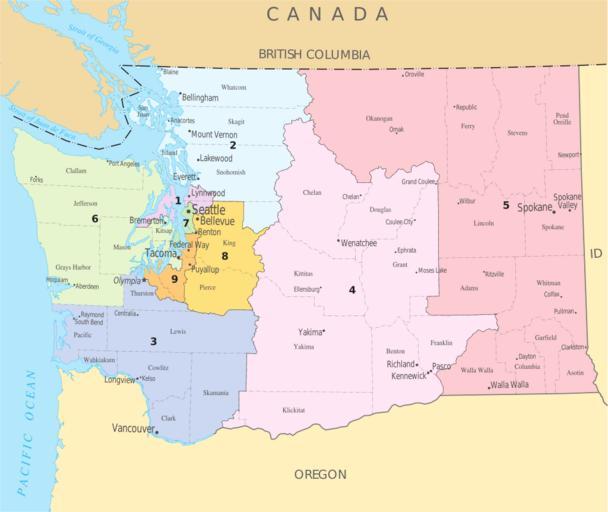
| View Original: | United_States_House_of_Representatives,_Washington_District_map.svg (743x625) | |||
| Download: | Original | Medium | Small | Thumb |
| Courtesy of: | commons.wikimedia.org | More Like This | ||
| Keywords: United States House of Representatives, Washington District map.svg en A map of the w Congressional districts of Washington The map is from http //nationalatlas gov/printable/congress html wa nationalatlas gov specifically http //nationalatlas gov/printable/images/pdf/congdist/pagecgd110_wa pdf the PDF Map of Washington's Congressional Districts U S Government 2008-02-05 PD-USGov-Atlas PD-USGov Congressional district maps of Washington state | ||||