MAKE A MEME
View Large Image

| View Original: | Upper Peninsula counties map.svg (614x584) | |||
| Download: | Original | Medium | Small | Thumb |
| Courtesy of: | commons.wikimedia.org | More Like This | ||
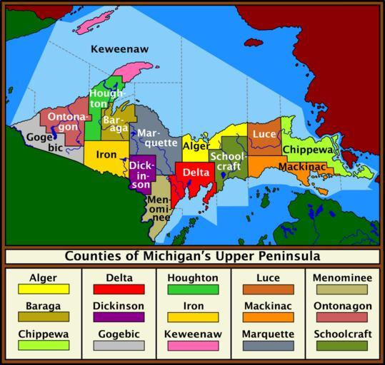
| Keywords: Upper Peninsula counties map.svg Color display of the counties of the Upper Peninsula of Michigan along with color-coded key Sources File Michigan Locator Map PNG File Michigan counties map gif Date 04 March 2010 Author Saukkomies 2010-03-04 Transferred from http //en wikipedia org en wikipedia by SreeBot Saukkomies at en wikipedia other versions Saukkomies Original upload log page en wikipedia Upper_Peninsula_counties_map svg Upload date User Bytes Dimensions Comment 2010-03-07 19 11 UTC Saukkomies 1932875 bytes 615×584 <small><nowiki>Color display of the counties of the Upper Peninsula of Michigan along with color-coded key <br /> <br /> Software used InkScape Sources <br /> <br /> File Michigan Locator Map PNG <br /> File Michigan counties map gif <br /> <br /> Date 07</nowiki></small> 2010-03-07 18 58 UTC Saukkomies 1928363 bytes 865×766 <small><nowiki>Color display of the counties of the Upper Peninsula of Michigan along with color-coded key Software used InkScape Sources File Michigan Locator Map PNG File Michigan counties map gif Date 07 March 2010 Author Saukkomies</nowiki></small> 2010-03-07 00 28 UTC en User Saukkomies Saukkomies 1928014 bytes 865×766 <small><nowiki>Color display of the counties of the Upper Peninsula of Michigan along with color-coded key Sources File Michigan Locator Map PNG File Michigan counties map gif Software used Inkscape Date 04 March 2010 Author Saukkomies</nowiki></small> 2010-03-04 16 32 UTC en User Saukkomies Saukkomies 955822 bytes 865×766 <small><nowiki>Fixing label display problem</nowiki></small> 2010-03-04 02 24 UTC Saukkomies 946881 bytes 865×766 <small><nowiki>Color display of the counties of the Upper Peninsula of Michigan along with color-coded key Sources File Michigan Locator Map PNG File Michigan counties map gif Date 04 March 2010 Author Saukkomies</nowiki></small> Upper Peninsula | ||||