MAKE A MEME
View Large Image

| View Original: | US Congressional Districts, party colors 2009 07 23.svg (2583x1556) | |||
| Download: | Original | Medium | Small | Thumb |
| Courtesy of: | commons.wikimedia.org | More Like This | ||
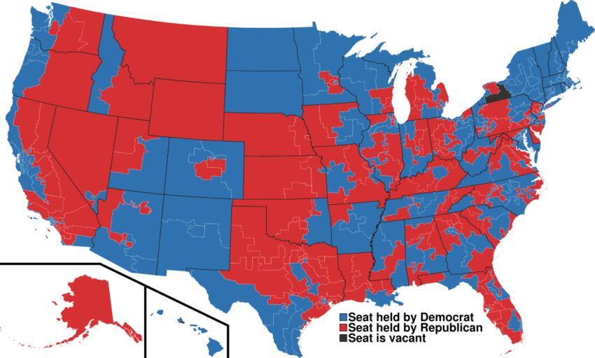
| Keywords: US Congressional Districts, party colors 2009 07 23.svg A map of all of the U S congressional districts as of the 111th Congress colors based on the party being held by the seat or its vacancy Based off of File US Congressional districts svg 2009-01-05 User Mr Matté/Author template Mr Matté original upload log wikitable date/time username resolution size edit summary ---- 2009-07-23T06 51 31Z User Goldfndr 2583×1557 1 06Gb <nowiki>Simplified stripped superfluous settings Slightly smaller size IDs' identifications improved </nowiki> ---- 2009-07-17T14 35 48Z User Mr Matté 2583×1557 1 06Gb <nowiki>Right format wrong Congress</nowiki> ---- 2009-07-17T14 19 46Z User Mr Matté 2583×1557 1 06Gb <nowiki>Fix NY 26/27 text hopefully works </nowiki> ---- 2009-01-05T18 27 36Z User Mr Matté 2583×1557 1 12Gb <nowiki>Updating for the 111th Congress</nowiki> ---- 2008-05-15T02 06 42Z User Mr Matté 2583×1557 1 17Gb <nowiki>Try to get Seat is vacant disappear now its master opacity is 0 </nowiki> ---- 2008-05-15T02 01 55Z User Mr Matté 2583×1557 1 17Gb <nowiki>Filled in vacant seats the Seat is vacant legend on the bottom is now hidden but still on the file</nowiki> ---- 2008-04-16T02 40 53Z User Mr Matté 2583×1557 1 17Gb <nowiki>Higher-quality smaller version of the congressional map by party</nowiki> ---- 2008-02-06T03 19 26Z User Mr Matté 9111×5493 1 69Gb <nowiki> A map of all of the U S congressional districts as of the 110th Congress colors based on the party being held by the seat or its vac</nowiki> Congressional district maps of the United States SVG maps of the United States Maps created by User Mr Matté | ||||