MAKE A MEME
View Large Image
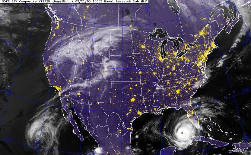
| View Original: | US_Navy_050921-N-2222R-002_GOES-12_Satellite_infrared_image_provided_by_the_U.S._Naval_Research_Laboratory,_Monterey,_Calif.,_showing_the_status_of_Hurricane_Rita_at_approximately_5-00_am_EST.jpg (1300x800) | |||
| Download: | Original | Medium | Small | Thumb |
| Courtesy of: | commons.wikimedia.org | More Like This | ||
| Keywords: US Navy 050921-N-2222R-002 GOES-12 Satellite infrared image provided by the U.S. Naval Research Laboratory, Monterey, Calif., showing the status of Hurricane Rita at approximately 5-00 am EST.jpg en Gulf of Mexico Sept 21 2005 GOES-12 Satellite infrared image provided by the U S Naval Research Laboratory Monterey Calif showing the status of Hurricane Rita at approximately 5 00 am EST Rita was upgraded to a Category 3 storm early Wednesday with 120 mph winds and forecasters said it could further intensify sparking an order for mandatory evacuations in New Orleans and Galveston Texas Rita is expected to become a category four hurricane later today The Military Sealift Command MSC hospital ship USNS Comfort T-AH 20 and other ships involved in Hurricane Katrina relief operations have been ordered to sortie in advance of Rita s arrival U S Navy photo RELEASED 2005-09-21 050921-N-2222R-002 Navy http //www navy mil/view_image asp id 28417 U S Navy photo PD-USGov-Military-Navy Hurricane Rita | ||||