MAKE A MEME
View Large Image
| View Original: | US_Navy_110827-N-ZZ999-001_A_GOES-13_infrared_satellite_image_provided_by_the_U.S._Naval_Research_Laboratory,_Monterey,_Calif.,_showing_the_status.jpg (1024x859) | |||
| Download: | Original | Medium | Small | Thumb |
| Courtesy of: | commons.wikimedia.org | More Like This | ||
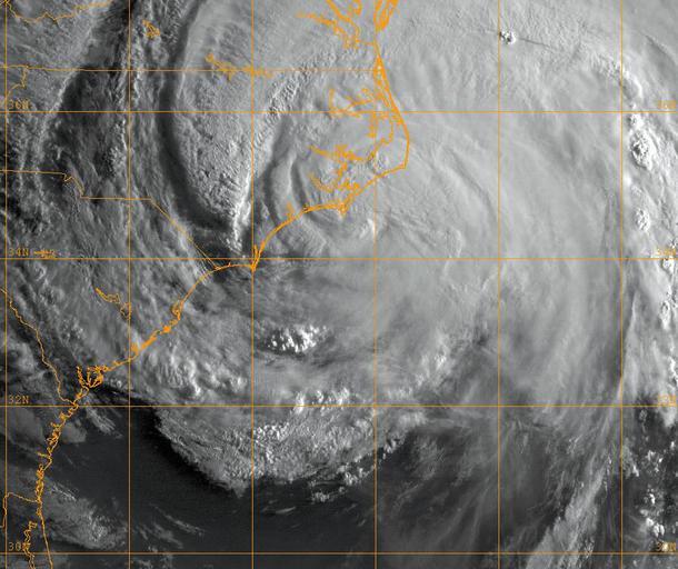
| Keywords: US Navy 110827-N-ZZ999-001 A GOES-13 infrared satellite image provided by the U.S. Naval Research Laboratory, Monterey, Calif., showing the status.jpg en ATLANTIC OCEAN Aug 27 2011 A GOES-13 infrared satellite image provided by the U S Naval Research Laboratory Monterey Calif showing the status of Hurricane Irene at approximately 1 a m EST Saturday Aug 27 Hurricane Irene made landfall near Cape Lookout N C as a Category 1 hurricane with sustained winds of 85 miles-per-hour U S Navy photo/Released 2011-08-27 110827-N-ZZ999-001 Navy http //www navy mil/view_image asp id 106386 U S Navy photo PD-USGov-Military-Navy Images from US Navy location ATLANTIC OCEAN Hurricane Irene Satellite pictures of extratropical cyclones | ||||