MAKE A MEME
View Large Image
| View Original: | USCAE_Bay_Model_-_San_Francisco_Bay_Detail.jpg (3648x2736) | |||
| Download: | Original | Medium | Small | Thumb |
| Courtesy of: | commons.wikimedia.org | More Like This | ||
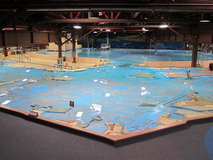
| Keywords: USCAE Bay Model - San Francisco Bay Detail.jpg U S Army Corps of Engineers Bay Model looking across the San Francisco Bay towards the Golden Gate and the Pacific Ocean The closest land feature from this perspective is the Point Isabel Regional Shoreline in Richmond Bay landmarks visible from left to right are the San Francisco “ Oakland Bay Bridge Yerba Buena Island Treasure Island Alcatraz Island Golden Gate Bridge and Angel Island Photo taken February 9 2012 http //en wikipedia org/w/index php title File 3AUSCAE_Bay_Model_-_San_Francisco_Bay_Detail jpg Something Original 2012-02-27 18 36 PD-USGov Check categories 2014 January 5 San Francisco Bay | ||||