MAKE A MEME
View Large Image
| View Original: | Virginia and Florida by W. Blaeu (MAM, Madrid, 413) 01.jpg (3120x2360) | |||
| Download: | Original | Medium | Small | Thumb |
| Courtesy of: | commons.wikimedia.org | More Like This | ||
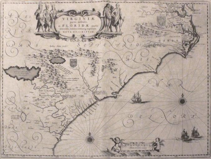
| Keywords: Virginia and Florida by W. Blaeu (MAM, Madrid, 413) 01.jpg Map depicting the former Colony of Virginia according to the Second Charter and part of Florida Mapa que muestra la antigua Colonia de Virginia segĂşn la Segunda Carta y parte de Florida Creator Willem Janszoon Blaeu between 1609 1638 Luis GarcĂa Zaqarbal 2013-09-12 PD-old-100 map date between 1609 1638 Nowadays Virgina North Carolina South Carolina Georgia and north of Florida Los actuales estados de Virginia Carolina del Norte Carolina del Sur Georgia y norte de Florida wikidata location Q1070529 la print date Museum Museo de AmĂ©rica accession number 413 Size cm 503 382 paper http //ceres mcu es/pages/Viewer accion 4 AMuseo MAM Museo MAM Ninv 00413 Museum's website “ Web del museo “ Site du musĂ©e other versions Taken with Canon EOS 1100D and Canon EF-S 18-55mm F3 5-5 6 IS Files by User Zaqarbal Collections of the Museo de AmĂ©rica Madrid Maps by Willem and Johannes Blaeu Old maps of Virginia Old maps of Florida Photographs taken on 2013-09-12 | ||||
-01.jpg)