MAKE A MEME
View Large Image
| View Original: | VOC_Octrooigebied_2.jpg (3000x1978) | |||
| Download: | Original | Medium | Small | Thumb |
| Courtesy of: | commons.wikimedia.org | More Like This | ||
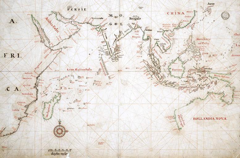
| Keywords: VOC Octrooigebied 2.jpg Map of the actual trade zone octrooigebied of the VOC between Cape of Good Hope South Africa and Japan; c 1665 The VOC establishments are marked with yellow dots and names in black http //www tanap net/content/voc/tradezone/tradezone htm TANAP 1665 PD-old-100 1665 maps Old maps of oceans Old maps of the Dutch East India Company Maps of the maritime history of India Maps in Dutch | ||||