MAKE A MEME
View Large Image
| View Original: | Warsaw-map-1831-closeup.jpg (1500x824) | |||
| Download: | Original | Medium | Small | Thumb |
| Courtesy of: | commons.wikimedia.org | More Like This | ||
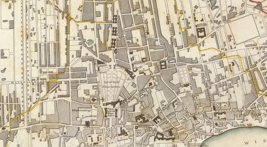
| Keywords: Warsaw-map-1831-closeup.jpg A close-up of the city centre of Warsaw as seen on a 1831 map of Warsaw Note that the map is not oriented and North is more or less on the right side of the map Also note a large number of typos Typos spotted Oyrod Krole park in the centre of the map should be Ogród Królewski Kozary Wielopolski six buildings to the north of the park should be called Koszary Wielopolskie Cekauz Arsenal to the right of the northern edge of the park should be called Cekhauz Patac Kroleski right below the park should be Pałac Królewski <br> PD-old Historical maps of Warsaw Warsaw in the 1830s Maps of Śródmieście Warsaw ImageNote 1 568 385 105 180 1500 824 2 Saxon Garden ImageNoteEnd 1 ImageNote 2 585 576 77 81 1500 824 2 Saxon Palace ImageNoteEnd 2 ImageNote 3 868 741 122 54 1500 824 2 Royal Castle ImageNoteEnd 3 | ||||