MAKE A MEME
View Large Image
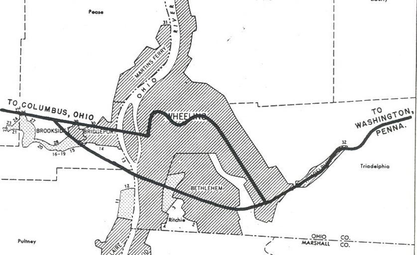
| View Original: | Wheeling, West Virginia 1955 Yellow Book (cropped).jpg (800x489) | |||
| Download: | Original | Medium | Small | Thumb |
| Courtesy of: | commons.wikimedia.org | More Like This | ||
| Keywords: Wheeling, West Virginia 1955 Yellow Book (cropped).jpg A map of planned Interstate Highway System in the w Wheeling West Virginia area Interstates in today's terms Interstate 70 top Interstate 470 Ohio “ West Virginia bottom Retouched picture Cropped image Admrboltz Wheeling West Virginia 1955 Yellow Book jpg Yellow Book Wheeling 99 1955 Public Roads Administration - Federal Works Agency predecessor to the United States Department of Transportation PD-USGov-DOC Admrboltz Wheeling West Virginia 1955 Yellow Book jpg 1955 Yellow Book maps 099c Wheeling West Virginia Interstate 70 in West Virginia Interstate 470 Ohio “ West Virginia West Virginia in the 1950s Maps of West Virginia | ||||
.jpg)