MAKE A MEME
View Large Image

| View Original: | Wisconsin Central 1998 map.png (968x1160) | |||
| Download: | Original | Medium | Small | Thumb |
| Courtesy of: | commons.wikimedia.org | More Like This | ||
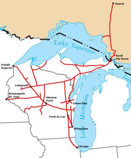
| Keywords: Wisconsin Central 1998 map.png Route map of the Wisconsin Central Railroad operations in North America in 1998 Map created by Sean Lamb User Slambo based on a map in the Wisconsin Central Railroad's 1998 Annual Report Political boundaries cropped from Image US_state_outline_map png railroad route and city locations and names added using the GIMP 2006-01-12 own assumed Slambo System maps of U S railroads Wisconsin Central Ltd | ||||